Things to Do
Paddling
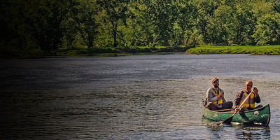
The Rio Grande is a must-do river for paddlers. You can explore it over half-day trips or multi-day outings, either with a permitted outfitter or on a self-guided trip. While the rim offers views of the river—which has carved out dramatic canyons with towering 100 million-year-old walls—the canyons are best experienced from water level. From your boat, make sure to keep an eye out for beavers, turtles, and great blue herons. Need to know: The middle of the river is the international border, and landing on the Mexican side is illegal (though it’s allowed if it’s for safety measures like bailing water or scouting a rapid). A backcountry permit is required for all river trips. Here are two standout sections:
Santa Elena Canyon: This 1- to 3-day stretch runs for 20 miles through a stunning canyon with 1,500-foot walls. And since the put-in and takeout are both accessible via a paved road, access is relatively easy. Start at Lajitas for a mellow 13 miles, followed by 7 miles of more moderate water where some technical paddling awaits (the “Rock Slide” is a Class IV rapid at certain water levels). The takeout is at the Santa Elena Canyon River Access. For a no-shuttle day trip in Santa Elena, paddle upstream in calm waters from the Santa Elena access and then turn around and float back to where you started.
Boquillas Canyon: A whopping 196 miles of the Rio Grande are designated as a Wild and Scenic River section, 33 miles of which you can paddle in Boquillas Canyon over the course of a few days. Put in at Rio Grande Village and take out at Heath Canyon. In between, you’ll pass between 1,200-foot canyon walls and drift past the remains of candelilla wax mining camps.
Hiking
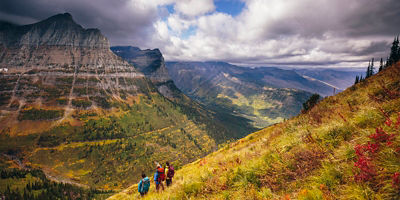
Big Bend offers excellent hiking on nearly 150 miles of trails. This trail network crosses everything from the high-alpine terrain in the Chisos Mountains to the endless Chihuahuan Desert (which covers some 80 percent of the park) to scenic jaunts along the Rio Grande. Here are a few best bets for each distinct offering:
Mountain: Hike to the top of Emory Peak, a 7,825-foot summit accessed via a grueling 5.25 miles (10.5-mile round-trip) from the Chisos Basin Trailhead. Wander along forested trails before heading up steep grades to the park’s highest point where wide-open views await. Want something more mild? Try the 5.6-mile round-trip Window Trail. This route passes through Oak Creek Canyon and offers sweeping views of the desert. For a longer journey, take a few days to backpack the 30-mile Outer Mountain Loop.
Desert: Check out the Chimneys Trail (4.8 miles round-trip) to explore volcanic formations and Indigenous rock art. For a flatter option, head to Dog Canyon for a 4-mile round-trip hike through a wash and into the canyon.
River: The 1.7-mile Santa Elena Canyon Trail is a favorite, and offers some insight into what paddlers get to see during their time on the water. From the trailhead (at the end of the Ross Maxwell Scenic Drive), you’ll walk into the mouth of the canyon and gain stunning views of the river. The 1.4-mile round-trip Boquillas Canyon Trail (starting at Boquillas Canyon Spur Road) takes hikers to a cliffside overlook of the Rio Grande.
Hot Springs
Walk a half-mile on the Hot Springs Historic Trail to take a dip in the 105-degree hot springs near Rio Grande Village.
Camping
Within the park, you’ll find backcountry camping and four developed campgrounds. Since there’s very little light pollution (a perk of being in the middle of nowhere), you’ll get to soak in views of an overwhelmingly starry sky. Many of the campsites can be reserved up to a year in advance for $16/night on Recreation.gov. The rest are first-come, first-served.
Rio Grande Village. The village has 93 sites for tents and RVs and is located near the river. The camp store offers groceries and showers, and the visitor center is nearby. Adjacent to the store is the RV campground (operated by a concessionaire) that has 25 sites with full hook-ups.
Chisos Basin. Its 60 sites are surrounded by cliffs and groves of cypress and mesquite trees. A number of trails are easily accessible from the camping. All sites must be reserved online.
Cottonwood Campground. This is a quieter spot near the Castolon Visitor Center. It has 22 sites at the end of Ross Maxwell Scenic Drive, just 8 miles from the Santa Elena Canyon Trailhead.
Backcountry Camping. There are 64 backcountry and primitive sites available and all require a permit. Keep in mind that these sites are often accessed via rugged roads and located in remote areas. You can secure advance permits for 34 of the campsites on Recreation.gov up to six months ahead of time. Permits for the other 30 sites located along River Road, Glenn Springs Road, and Old Maverick Road must be secured in person at the Panther Junction Visitor Center or Chisos Basin Visitor Center.
Scenic Drives
Photogenic drives and overlanding routes abound at Big Bend. Check out the 6-mile Chisos Basin Road, which transitions from the rolling desert to the mountainous Chisos Basin—a worthy destination in its own right, with tons of hiking trails plus a visitor center and campground. The 30-mile Ross Maxwell Scenic Drive passes a number of stellar overlooks (like Sotol Vista and Tuff Canyon) and also leads to the popular Santa Elena Canyon, a jump-off point for hiking and paddling. The Dagger Flat Auto Trail is a dirt road that most vehicles (and mountain bikes) can tackle. There are also a number of more rugged overlanding routes, like Glenn Springs Road, Old Ore Road, and the rowdy Black Gap Road. To attempt those, you should be an experienced off-roader with a high-clearance, four-wheel-drive vehicle.
Supplies
There are some general stores and gas stations in the park, but you’ll want to be prepared with what you need before you arrive. Stock up in Midland or in Terlingua (a few miles west of the Maverick Junction entrance). Bring at least a gallon of water per person per day no matter if you’re in your car or on foot.
