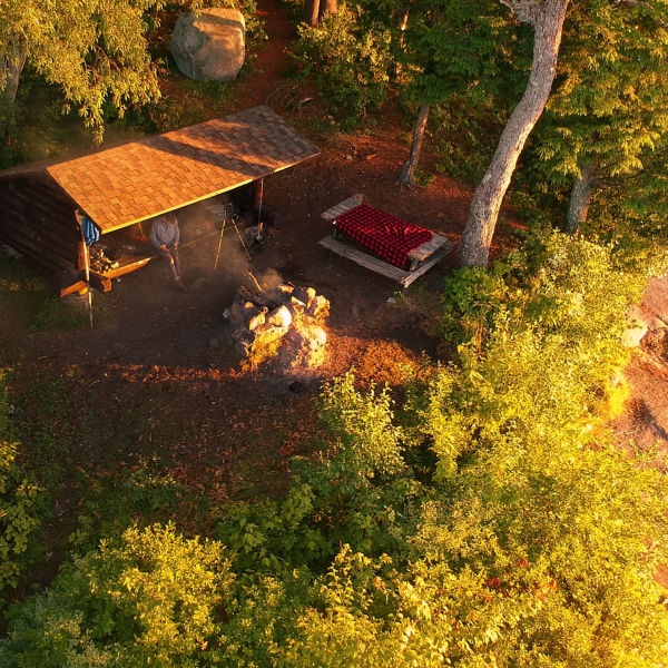
Aerial drone view of paddling at Hurricane Island on Flagstaff Lake, Maine along the Northern Forest Canoe Trail

Exploring 5 of America’s Top Water Trails

Photo: Aaron Black-Schmidt/Tandemstock

A slew of designated water trails across the U.S. also make it easy to tour stunning multi-day routes via canoe, kayak, or standup paddleboard.

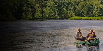
You’ve likely heard of classic backpacking routes like the Appalachian, Continental Divide or Pacific Crest trails. They aren’t the country’s only marquee wilderness pathways. A slew of designated water trails across the U.S. also make it easy to tour stunning multi-day routes via canoe, kayak, or standup paddleboard. Exploring a water trail takes all the guesswork out of your outing, whether you’re launching a leaf-peeping weekend trip in your canoe or a longer trek in a loaded sea kayak. These often overlooked trails offer everything from maps to well-marked access points and campsites. Leave little to chance on your foray into the wilderness—and leave logistical worries behind with your wake with the following five water-trail classics to put on your list.

Maine Island Trail 

For some of the most pristine paddling on the planet, sink your blades into the Maine Island Trail, the country’s first water trail. Established in 1988, the Maine Trail established the paddling precedent for all others after it. The 350-mile-long waterway extends from Cape Porpoise Harbor on the west to Machias Bay on the east, with its namesake Maine Island Trail Association (MITA), the largest of its kind on the continent. Camp at one of 150 island and mainland sites along the route, each accessible by kayak, sailboat or other watercraft. Campsites on state land are free, while those on private islands are available with MITA membership (starting at $25). July, August and September typically offer the best weather, with September offering the bonus of lobster-red leaves. More Info: mita.org

Northern Forest Canoe Trail  

Tracing Native American and early European settler canoe routes, the Northern Forest Canoe Trail is the longest paddling trail in the nation, running 740 miles from Old Forge, N.Y, through Vermont, Québec, and New Hampshire to Fort Kent, Maine. Established in 2000 to connect people to the region’s environment, human heritage and communities, it’s been named the country’s “Best Canoe Trail” by Outside magazine, with its nonprofit organizing body providing maps, route selection options and more to anyone interested in paddling any or all of it. “It’s our vision to strengthen communities—both of paddlers and of place—through 740 miles of paddling in the northern forest,” says NFCT Executive Director Karrie Thomas. “We hope to inspire paddlers to recreate here and contribute to the resilience of the communities along its corridor, from the Adirondacks to Maine.” More Info: northernforestcanoetrail.org 

A man paddles a kayak past a moose on the Penobscot River in Northern Maine. This river is part of the Northern Forest Canoe Trail. Photo: Aaron Black-Schmidt/Tandemstock

Suwannee River Wilderness Trail, Fla. 

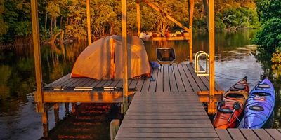
Running through six state parks, the 170-mile-long Suwannee River Trail divides Florida’s panhandle from the rest of the state. Extending from the Stephen Foster Folk Culture Center Park to the Gulf of Mexico, it’s perfect for canoeists and sea kayakers of all strokes. You’ll paddle its black, tannin-filled waters past three river camps spaced between eight access points, each with restrooms, showers and campsites. You’ll also retrace the wake of the 16th century Timuccuan people who used to live along the river’s banks. While they named it Suwani, meaning “Echo River,” you won’t resist creating echoes of your own as you belt out “Old Folks at Home,” the state song of Florida, to the cadence of your strokes (rumor has it that no one’s ever paddled the Suwannee without breaking out into song). More Info: floridastateparks.org  

Lake Superior Water Trail

Sea kayak the world’s largest freshwater lake on the Lake Superior Water Trail, which extends from the St. Louis River in Duluth, Minn., to the Pigeon River marking the U.S.-Canada border. The trail’s concept was born in 1991, with legislation making it official two years later. Maintained through a partnership of more than 100 individuals, families, businesses and organizations, the trail is open to all non-motorized craft, with new campsites added each year. Groups of six can camp at official water trail sites, available for free on a first-come, first-served basis. You can also pay $7 per night to bed down—enjoying a warm fire with flames that match the reds and yellows of nearby Pictured Rocks National Seashore—at any number of state park campsites en route. More Info: dnr.state.mn.us 

Cascadia Marine Trail

If the Maine trail has an equivalent out West, it’s the Cascadia Marine Trail, which stretches more than 140 miles through Puget Sound from just outside Olympia, Wash., to the Canadian Border. Since 1993, thousands of paddlers have traversed this inland sea trail, which was recently designated as one of 16 National Millennium Trails by the White House. More than 50 campsites are accessible from a variety of public and private launch sites and shoreline trailheads; some are free, others require nominal fees and reservations, and still others are self-service pay as you go. Wherever you stay, expect a whale of a good time. More Info: wwta.org

All articles are for general informational purposes.  Each individual’s needs, preferences, goals and abilities may vary.  Be sure to obtain all appropriate training, expert supervision and/or medical advice before engaging in strenuous or potentially hazardous activity.

MORE STORIES