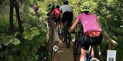
Like any historic town, Charlottesville is a city with many facets. See them all on the 20-mile Rivanna Trail, which loops around the entire city and stitches together some of its best scenery. The full tour is intermediate in difficulty and requires only a mountain bike, a helmet and some basic navigational savvy. (You can do much of the trail on a gravel bike, but several sections, like the Quarry Park to Woolen Mills section, are pretty technical and rocky.)
What is the Rivanna Trail?
If the Rivanna Trail isn’t already on your backyard bucket-list, it should be. This 20-mile loop is a gorgeous, motley patchwork of dirt singletrack and paved greenways, wooded stretches and city parks, public land and private parcels. On the way, you’ll roll past the University of Virginia’s historic campus, cross a handful of Charlottesville’s most beloved city parks, and skirt burbling streams and the fast-flowing Rivanna River. It’s a perfect way to get to know this scenic and historic city from a whole new perspective.
About the Route
Originally designed as an urban hiking route, most of the Rivanna Trail is gently rolling. Over 20 miles, you’ll tackle 900 feet of elevation gain, most of which is piled onto the east side of the loop, near the university campus. Keep in mind that most of the route is well-suited to intermediate-level bikers, but you may have to hop off your bike briefly to cross streams or other obstacles. Fortunately, there’s plentiful information available on this classic route (including an app) to help you find your way.


